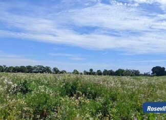
By a 5-0 vote, the Placer County Board of Supervisors approved the proposed Placer Vineyards Specific Plan on Monday, July 16, 2007.
Board members followed the recommendation made by the Planning Commission in January, which called for 14,132 residential units, called the “base plan” to distinguish it from the “blueprint plan”, which could have added more than 21,000 units. Supervisors also expressed a willingness to close Locust Road to through traffic, as requested by residents in the region, pending a study to be done.
At the hearing, the Board certified the project’s environmental document; approved the Specific Plan and Development and Land Use Standards and approved amendments to the Placer County General Plan and Dry Creek / West Placer Community Plan.
Placer Vineyards will be a mixed-use community including residential, retail commercial and other uses, as well as public facilities such as parks, schools, and open space. At project build out, in 20 to 30 years, population of Placer Vineyards will be approximately 32,800 persons.
As proposed by the applicant and recommended by the Planning Commission, Placer Vineyards will include a maximum of:
14,132 residential units, including;
3,519 units low-density residential lots (an average density of 3.5 units per acre)
6,474 medium-density lots (an average density of 5.5 units per acre);
3,092 units high-density lots (an average density of 15 units per acre);
636 units commercial-mixed use (residential units averaging 12.5 per acre); and
411 rural residential units.
274 acres of commercial area;
1,561 acres of public/quasi-public uses (including public service facilities, religious facilities, schools, and major roadways. This also includes 211 acres of parks and 709 acres of open space).
The Placer Vineyards project will be built at the southwest corner of Placer County, generally bounded by Baseline Road on the north, the Sacramento County border on the south, the Sutter County border on the west and Walerga Road and Dry Creek on the east. The proposed project includes approximately 5,230 acres (about eight square miles) and stretches about six miles from east to west.
In 1994, the Board of Supervisors adopted the Placer County General Plan, including the establishment of a specific plan area for West Placer (now known as the Placer Vineyards Specific Plan area) which allowed for the development of up to 14, 132 residential units and a variety of commercial and industrial land uses.
(21+ years strong)
Welcome to the brighter side!
Get in front of local customers! 24/7 (365)


