Expanding access to outdoor recreation
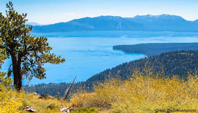
AUBURN, Calif. – Placer County is seeking public input for its North Tahoe Recreation Access Plan.
The plan proposes several trailhead parking and staging area sites that would provide increased access to public outdoor recreation areas.
Access points and trailhead locations are increasingly overcrowded beyond capacity causing parking conflicts, maintenance issues and traffic-related safety concerns. Winter parking is overflowing on the state Route 267 road shoulder at Brockway Summit. This is a common problem throughout the region, especially during winter use of public trails.
Striking a balance
As recreational activities increase, the need to manage and improve access points to public lands becomes more important. The plan will provide local public agencies with a valuable resource for planning, improving and maintaining year-round public recreational access sites in the North Lake Tahoe/Truckee region. Key objectives of the plan include projects that balance user needs and interests while supporting sustainable benefits to the environment, residents and the local economy.
The study area includes multiple locations in eastern Placer County along or near state Routes 89, 28 and 267. The proposed improvements include expanded parking, restrooms, trash receptacles, signage, drainage and water quality improvements. Operational changes may include plowing, maintenance of trash and restroom facilities, pavement, vegetation and other site management changes.
An example is the Dollar Creek Trailhead that is accessed from state Route 28, which needs disabled access parking, a bicycle rack, a wildlife-proof trash receptacle and waste pickup service.
Placer County is working with multiple stakeholders including public and private property owners and land managers to learn about existing proposed plans related to trail recreation and to explore partnership opportunities. Additional stakeholders include regulatory agencies, neighborhood associations, recreation-based businesses, nonprofit trail user groups and other organized trail user groups.
The county is seeking public input on experiences, suggestions and concerns regarding outdoor recreational access, as well as direct feedback on the proposed improvement projects.
Give Feedback (Short Survey)
A webpage with information is available at North Tahoe Recreation Access Plan. The webpage includes location maps, study documents and site information. The public may also provide feedback about the plan by taking a short survey. Additional public input opportunities will be publicized once scheduled.
(21+ years strong)
Welcome to the brighter side!
Get in front of local customers! 24/7 (365)


