New Road Opens in Folsom Plan Area, Section of Placerville Road Closing Monday
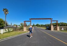
Folsom, Calif. – Alder Creek Parkway, a new thoroughfare that connects Scott Road to Placerville Road south of Highway 50 in Folsom, is now open.
A portion of Placerville Road from just north of Highway 50 to Alder Creek Parkway will close the third week of July for additional improvements and will remain closed through mid-August. Detour signs will be posted and businesses in the Folsom Pointe center, such as Mikuni, Starbucks, Hampton Inn & Suites and In-N-Out Burger, can continue to be accessed from East Bidwell Street.
The first stretch of Alder Creek Parkway, which is planned as a major east-west thoroughfare in the Folsom Plan Area, offers a new connection from Placerville Road to Scott Road for drivers traveling north and south of Highway 50. Scott Road south of Alder Creek Parkway to White Rock Road will remain closed through the end of the year.
The work is part of an 18-month schedule of infrastructure and road improvements south of Highway 50 in the Folsom Plan Area.
Construction activities planned for the summer include infrastructure and safety improvements such as water, sewer, streets and utilities. The Sacramento Municipal Utility District is building a substation to serve the area with electrical power.
The first homes are expected to be completed at Folsom Ranch (the portion of the site west of Placerville Road) in 2018 and the first homes and a community clubhouse are expected at Russell Ranch (east of Placerville Road to the county line) in 2019. Highlights of the plan area include more than 500 contiguous acres of oak woodlands, 138 acres of community parks, 20 miles of trails, a vibrant town center, new homes, transit improvements to mitigate traffic impacts, up to 8,000 high quality jobs, and a new high school, middle school and elementary schools.
The 3,520-acre Folsom Plan Area was annexed into the City of Folsom in 2011. Planned in accordance with Measure W, a ballot measure passed by Folsom voters, land owners were required to secure an independent water supply for the plan area, provide transportation improvements to mitigate traffic impacts, preserve 30 percent of the land as natural open space, and allow for new schools, all at no cost to existing Folsom residents. The plan that met those requirements was adopted by the Folsom City Council in 2012. The plan area was the subject of a visioning process instituted by the City of Folsom with hundreds of residents at dozens of public hearings addressing a range of issues including land use, open space, transportation, and financing.
Their recommendations resulted in scenarios reviewed by the Folsom City Council in 2005, which ultimately evolved into the design adopted by the city seven years later.
(21+ years strong)
Welcome to the brighter side!
Get in front of local customers! 24/7 (365)


